Revolutionizing Infrastructure Monitoring and Management
InfraView 360 by Synthetics Imaging offers a groundbreaking approach to infrastructure monitoring and management. Our advanced camera technology can automatically recognize infrastructure components, even when only a portion is visible, and measure them with centimeter-grade accuracy. Coupled with precise geolocation in XYZ coordinates, this capability transforms how inventory and inspections are conducted, bringing unprecedented efficiency and accuracy.
Automatic Recognition and Measurement
InfraView 360 is designed to identify infrastructure elements and components automatically. Utilizing advanced AI and Neural Radiance Fields (NERF) technology, our system can detect and measure objects even when partially obscured. This ensures that every component is accurately assessed and geolocated, providing a comprehensive view of the infrastructure.
Key Benefits
Centimeter-Grade Accuracy:
Automatically measures and geolocates infrastructure components with centimeter precision.
Efficient Inventory and Inspection:
Streamlines the process of asset management, reducing the need for expensive and time-consuming methods.
Real-Time Reporting:
Delivers instant data and analysis, facilitating quicker decision-making and response.
Transformative Applications

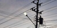
Joint-Use Pole Audits
InfraView 360 can be applied to ground vehicles to automatically scan joint-use poles and perform audits. This eliminates the need for costly LiDAR technology and the associated data handling and processing. Our system provides accurate measurements and geolocations, streamlining the audit process and reducing operational costs.

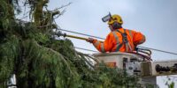
Vegetation Ingress Inspection
When mounted on drones, InfraView 360 can automatically detect vegetation encroachment along utility corridors. The system identifies and reports encroachments in real-time, significantly reducing the need for extensive data handling and processing. This enables utility companies to maintain clear corridors more efficiently and cost-effectively.

Emergency Response
In emergency situations, InfraView 360 can rapidly assess damage to infrastructure, allowing organizations to strategically prioritize resources and expedite recovery efforts. Accurate, real-time data on the extent and location of damage ensures that critical repairs are addressed promptly, facilitating a faster return to normal operations.
Join Us in Transforming Infrastructure Management
Invest in InfraView 360 by Synthetics Imaging and revolutionize your infrastructure monitoring and management processes. Our technology delivers unparalleled accuracy and efficiency, enhancing operational capabilities across various applications. Contact us today to learn more about how InfraView 360 can transform your infrastructure solutions.
